Monday 26th August
Simon my son, and I set off on a windy overcast day up Spurling Creek to find the way up The Rimwall Summit.
Spurling Creek is 22 km from the Bow River Bridge up the Spray Lakes road from Canmore. Park on the lake side of the Hwy and walk across the road to the trail head. The flood has done some damage to the parking and ditches but all has been repaired. This is the same trail to the West Wind Ridge Col and Wind Tower Mountain.
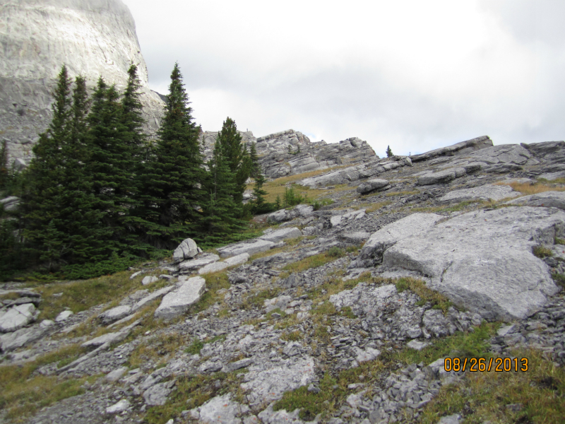
We went up until nearly above tree line before we cut to the left.The route is clear but as the photo shows you now have to down climb to get around the rock band. There are also other smaller rock bands that have to be scrambled over. I would suggest that after 1.3 km bear left at a 11 o’clock bearing. I red flagged this take off. Walk up through the trees keeping the rock edge close to your right. When you see the big rock wall start, shown on the photo head towards it. No trails to be found anywhere.
The way up is now ahead and any good-looking way is ok. Reach the ridge and look to your left ,yes it’s still a way’s to go.
The last piece to the summit has two small rock bands to negotiate, cairns and a well trodden path help find the way.
The way down is a lot easier as you can traverse down the black dirt and rock over a water channel and then down a scree slope.At the end of the scree go left to come back to the bottom of the rock band and back the same way.
Went up again in May 2015, Started up at an earlier turn and came out at the foot of the rock wall we had previously had to wall around. When we came down on the black scree we were further over but still hit the trail just below the waypoint marked left.
Elevation gain 1190 m Elevation 2680 m. Distance 7.9 km. Total time 6 hrs ( lost time to route finding )
2 X Time 1025m 2688m 6.2 km 5hrs
Not the right way to go but if you do you have to climb over the rock ridges


Recent Comments