
Coming up the edge of the boulder field Spray Lakes behind
June 15th Wednesday 2016
We set off from Canmore with the objective of going up Red Ridge from Spray Day Use Area and coming back through Sparrowhawk tarns and back to Sparrowhawk Day Use Area. It is about 2km between the day use areas. A car would have been left at Sparrowhawk. What we did not plan on was the cold, the wind, and the snow. Put all that together and it was not a pleasant day so we never made it to the final Col to drop into the Tarns. We did make it to the Red Ridge summit and could see the col. It would be drop of 250 odd meters down to the col and the chance that the cornice we could see impeding the passage down we returned back the same way. I guess it is good to leave something on the table for next time.
The hike/scramble up to Red Ridge is described in Dafferns Vol 3. This is how I saw it. Start from Spray Day Use and walk across the road. The High Rockies Trail now has a link from here so there is a good trail up to connect with main trail. At this intersection turn right or south and immediately on the left is a cairn and trail. ( if you see the bridge you have gone to far ) Follow this as best you can along the creek at 300m to 400m trail leaves creek. Take the right trail under a tree. In another 0.5 km intersect with another trail go left. Most of these trails are faint and appear and disappear. Be prepared to do a lot of bush whacking. A some point you will see the boulder field above through the trees keep left but still pushing up hill. In about 0.5 km you are on the left of the boulders. Stay off them as long as possible before diving in to get up onto the ridge. Then it is a smorgasbord of rocks to the summit with lots of dips or cols between each high point.

At the junction of the High Rockies Trail. Trail to Red Ridge is 1 meter to the right at the cairn.

Reads Tower and Mt Sparrowhawk hidden in the cloud

Dam it another one to reach

Looking back down the ridge

Still some winter left over

One of the larger Sparrowhawk Tarns

Looking from the summit to the Col

Red Ridge in the sun in the PM

Grand view of Red Ridge from the Spray day use area.

Closer look of Red Ridge top left the boulder field
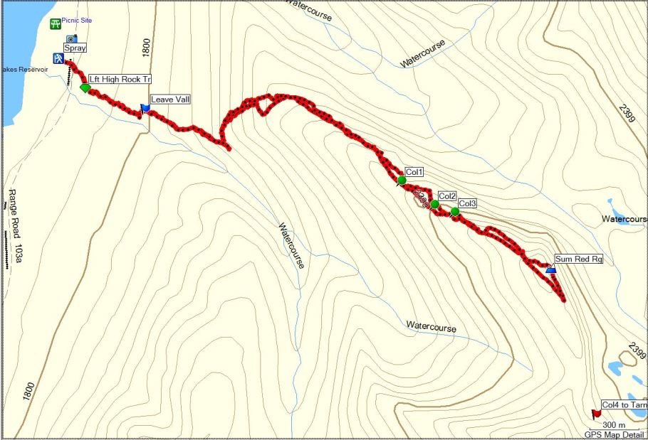

Distance return 8.8 km Time return 5:45 hrs ( inc 30 min lunch ) Elevation Accumulated gain 1168 m Elevation to Summit 900m Summit height 2662 m
[recaptcha_form]

[…] Red Ridge […]