October 7th 2015
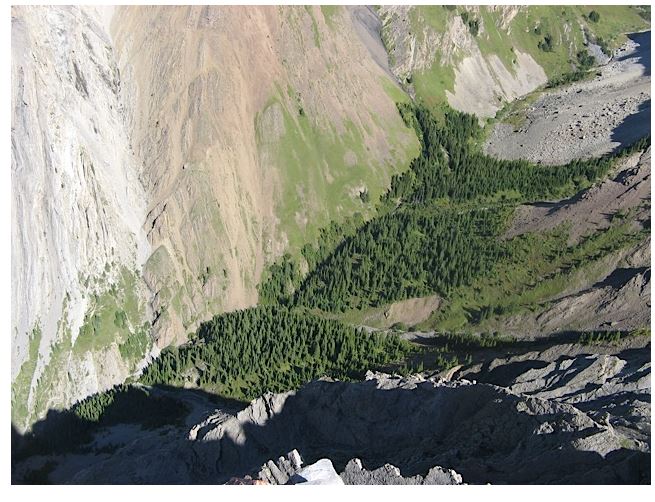
Opal Ridge South starts at the Fortress Junction Service Station on Hwy 40 opposite to the Fortress Ski Resort turn. From the north end of the parking find the trail and head up to the power line cut. Head left to the first water gully about 275 m and find the cairn for the trail up on the north side of the gully. At this point I should point out that we intended to return via Grizzly Creek so we had left are bikes 3.0 km up the road at the paved pull off for Grizzly Creek day use. The trail is steep but mostly interesting as there are few trees. The picture below shows the Gates but it’s just a gap between the rocks. From the gates cross over the col to Opal Ridge and the start of a nice ridge hike of about 2 km. The idea to return back through Grizzly Creek came from Dafferns trail guide. The book says to follow the trail but we never found one. After dropping in to the creek we edged are way on the right bank until a rock gorge forced us to the left. Catching intermittent animal trails and bush whacking through trees brought us to the rock fall under Grizzly Peak. We traversed somewhere low middle on very shaky footing. As we knew we had to go left onto the west slopes of Grizzly Peak we stayed high through the trees. Eventually we found some good game trails that took us out onto the open west slopes. Continuing on along the west slopes until past the hidden cliffs below before heading down to the bikes. No trails again but open forest made the going easy. At the bikes it was an easy downhill ride back to the car. Now, if I had to do Grizzly Creek again I think I would go down to the creek at the rock slide and try working along the right side of the creek as there appears to be less vegetation.
Distance return 12.0 km Time return 6 hr ( inc 30 min lunch ) Elevation Accumulated gain 1200 m Elevation to Summit 1045 m Summit height 2615 m
[recaptcha_form]


[…] so I have marked it on the GPS Map. The summit has the same vantage point s as Opal Ridge South https://willski.ca/opal-ridge-south-grizzly-creek/ and King Creek Ridge. https://willski.ca/king-creek-ridge/ Across the Kananaskis Valley is Lawson […]