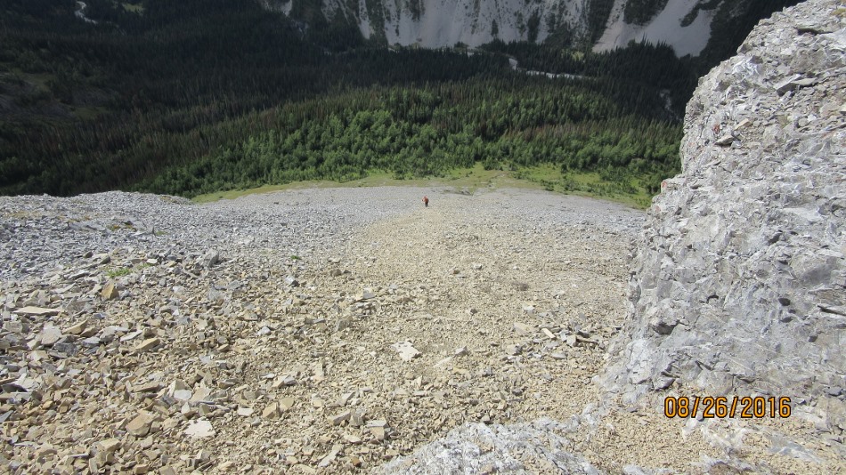
Mt Murray summit down to Cegnfs
August 26th 2016.
Mt Murray and Cegnfs trail head is at Burstall Pass trailhead on the Spray Lakes Road. Today I joined the Rocky Mountain Ramblers Club from Calgary. Thanks John who lead the scramble and Kevin for joining us. We left the parking area and took the first left to French Creek. I believe the second left also goes to French Creek but that would keep to the right side of the creek to the falls. This way we crossed the Trans Alta dam and stayed on the left of the creek. From the dam we took a soaking pushing through wet over ground bush on the old logging roads. Every time we came to the creek we would then turn back left into the trees to avoid the creek. After about 3.8km turn left up a flooded rock damaged creek. Continue until into the narrow creek bed. Then at the fork at the gate gorge turn right up a steep gully. Cegnfs is on the left. Try to find any animal, human trail and grind up the large scree. One false summit before the summit of Cegnfs and you are rewarded with the view down to the col and onto next destination Mt Murray. Cegnfs is 885m from the trailhead. Loose 140m down to the col and then gain another 355m to Mt Murray. The view from Cegnfs to Mt Murray is daunting but less so when actually there. The scree continues. When closing in on the summit block there are a few options Kane suggests scrambling up a chute. In fact there are two chutes, see photos. I followed the trodden trail and came around to a nice ridge that lead to the summit cairn. On the descent after the col work across under Cegnfs trying to stay high as there is a large steep rock band below. Choose one of the scree shuts down to the trees and back into the gate gap gorge. Just to keep things straight Cegnfs is an unpronounceable name for an a peak named after the initials of the names of the first party to ascent the peak. Mt Murray was one of those British General from the first world war.

Cross Trans Alta dam along French Creek

At French Creek before going left into trees

Now hiking in the creek. Gate Gorge at top.

Follow the Gate Gorge to the right along this wall. Keep right.

Rubbling up to Cegnfs Peak

Not the summit of Cegnfs

Dave on Cegnfs summit. I was happy to get there as well.

Just a matter of going down and back up. Note faint trail.

Faint trail up Mt Murray

Mt Murray heading right across scree

That’s Mt Murray summit the ridge route. That I took. The chimney chutes come up on the other side of the summit

Mt Murray summit down to Cegnfs

A view from Mt Murray

One of the chutes to the Mt Murray summit

Kanes chute to Mt Murray summit

The col across from Cegnfs to Mt Murray

Bill on the Mt Murray. Jigsaw puzzle of rocks right to the end.


Distance return 14 km Time return 8:45 hrs ( inc 30 min lunch ) Elevation Accumulated gain 1470 m Loss 140 m Gain 355 m from Cegnfs Elevation to Summit 1117 m Summit height 3026 m
[recaptcha_form]

Recent Comments