Mt Ishbel Shoulder

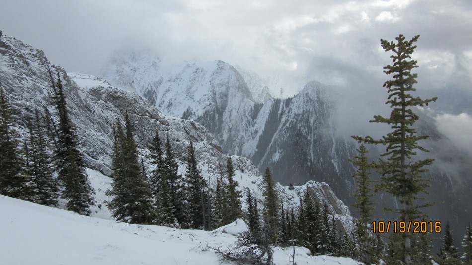
Castle Mountain

Castle Mountain From Mt Ishbel shoulder

October 19th 2016.

Mt Ishbel lies between Johnston Canyon, west and Mt Cockscomb, east. The approach is at Ranger Creek from Hwy 1A. 11 km from the Banff turn off from Hwy 1. Hillsdale Meadow Exhibit is just past Ranger Creek. Taking the flood damaged creek may not be the best approach now. We returned through Hillside Meadow and this way avoids some of the dead fall and the creek. Any way we used the creek and then headed up the ridge with burnt trees and dead fall. We stayed on the ridge all the way up to our high point of the day. Coming down we dropped earlier into the gully and the back to the ridge. Then, when we could see the meadow without any rock bands below  we headed down through the bush in that direction. At the high point we travelled across a rock face to see if there was a further way up. I have read that is the way to go and then find a weakness up past the cliff. On this snowy day it was not suitable to try any further. At the point under the cliffs was when we encountered the sheep. They had a route up and were determined to stick to it. We were on a small rock rise investigating the track of one sheep when three more appeared. They wanted to come that way but reluctantly decided to by pass us. Later we saw them as shown in the pictures below.


Ranger Creek

Ranger Creek after leaving Hwy 1A

Fire burnt start of shoulder

Fire burnt start of shoulder

Lot's of dead fall

Lot’s of dead fall

Pointing to the way ahead

Pointing to the way ahead to the gully we would return by.

Climbing up to the main shoulder

Climbing up to the main shoulder

Pushing on in low cloud and snow

Pushing on in low cloud and snow

Aiming for the high point

Aiming for the high point

Looking back down.Gully in view

Looking back down. Gully in view on right

Lee posing on a high point

Lee posing on a high point

We followed the steep cliff right looking for a route to go higher. Only the goats got higher

We followed the steep cliff right looking for a route to go higher. Only the goats got higher

At this point he realised were not moving

At this point he realised were not moving. See more goat photos in the gallery

This is the goats high point .They stayed up there all afternoon

This is the goats high point .They stayed up there all afternoon

This shows where we went on the left

This shows where we went on the left

Mt Cockscomb

Mt Cockscomb


Coming back we headed towards the meadow to by pass Ranger Creek.

Coming back we headed towards the meadow to by pass Ranger Creek. Then walked back down the road.

In the meadow looking back at Mt Ishbel Shoulder

In the meadow looking back at Mt Ishbel Shoulder

mt-ishbel-shoulder


mt-ishbel-shoulder-profile

Distance return 8.3 km Time return 6 hrs ( inc 30 min lunch ) Elevation Accumulated gain 995 m Elevation to Summit 810 m Summit height 2270 m

GPS Download

Google Earth KML

That would be Mt Cockscomb in the cloud

Image 12 of 20

That would be Mt Cockscomb in the cloud

[recaptcha_form]