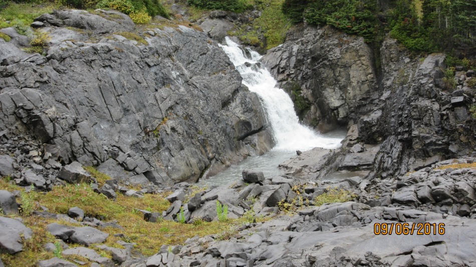
Falls before Aster Lake Camp ground
September 6th 2016.
The weather forecast was good on the Mountain Weather site, bad on Norway forecast and good on Weather Network. I don’t think it matters for this area it has it own weather system. Clouds lingered all day. Fine rain fell most of the day. The rest of Kananskis looked dry. Oh well, we set off anyway from the Upper Parking at Kananaskis Lake. It is 1.2 km to Rawson Lake turn off and the bridge across Sarrail Creek is now installed. This is the last one around the lake to be completed. Then another 4 km to the Hidden Lake turn. I would not recommend taking the short cut that the picture shows due to a massive amount of dead fall and a small hill to be surmounted. Walk the extra 480m to the main Hidden lake turn. The trail soon comes to Hidden Lake 500m which is a seasonal lake. No too much water in at this time of year. Then the trail leads up the first headwall to give views of Fossil Falls. At the top of the headwall would be the place to wander off to check out the falls. We passed the opportunity due to the length of the hike to Aster lake. Next is the trail on the scree slope below Mt Sarrail. The views back to Hidden Lake and across to Fossil Falls dominate. A rock wall appears to block the way but a trail winds through leading to a nice treed vale. After walking across Foch Pond, if dry. Observe the sign to the Ranger Station and the turn to Marlborough Pond. Carry on to a right turn down a creek that leads to a left turn at Aster Creek. This is the final stretch up to Aster Lake and the campground. Passing waterfalls and a gushing creek. A steep rise up to the campground and follow the creek to see the waterfalls and Aster Lake. I think it would look beautiful on a clear day but today not so. One quick photo and we were out of there back to the campground for lunch. Return the same way less your destination is Northover Pass and Three Isle Lake. Backpacking required.

New bridge at Sarrail Creek. They are now all complete around the lake

Nice carving at turn. This is for the short cut 480m to the main turn.

Very little water in Hidden Lake

At the first headwall looking back at Hidden Lake and the take off to Fossil Falls.

Crossing the scree under Mt Sarrail to the next headwall.

Fossil Falls

Hidden Lake with the trail coming up across the scree.

Trail goes through this rock band to Aster Lake. Backpackers descending.

Level with Fossil Falls just before the rock band.

Foch Pond is empty we would walk across it on the way back

Aster Creek

Falls at the Aster lake camp ground

Miserable view of Aster Lake


Distance return 22 km Time return 8 hrs ( inc 30 min lunch ) Elevation Accumulated gain 770 m Elevation to Summit 530 m Summit height 2260 m
Stats and GPS incomplete due to a malfunction.
[recaptcha_form]

Recent Comments